

Places to Visit Around Trois Rivières
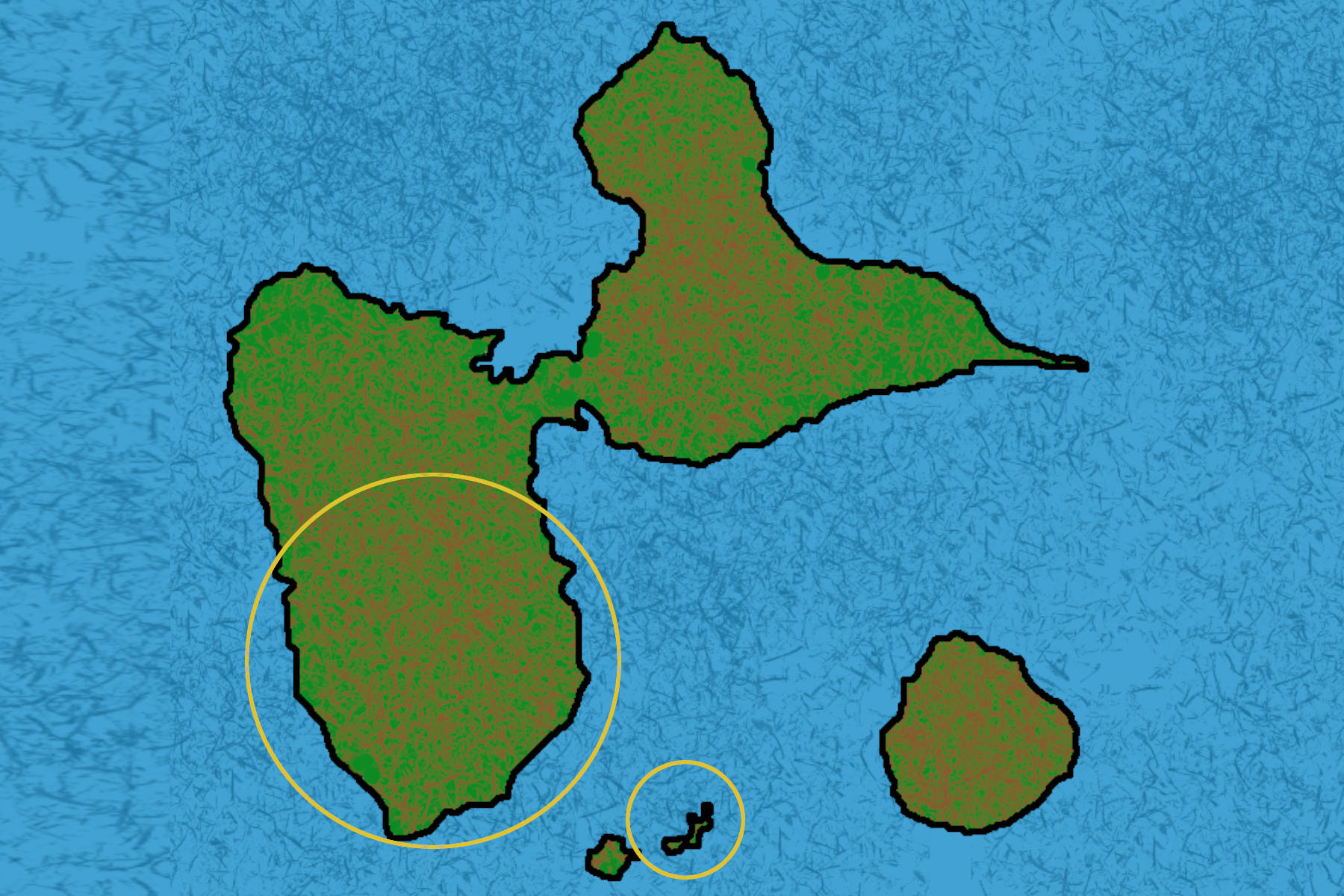
Discover Southern Basse-Terre

There are countless beautiful places to discover in southern Basse-Terre, a region immersed in lush tropical vegetation. Some lesser-known spots are absolutely charming and home to an incredibly diverse range of wildlife and plant life.
It takes time to venture off the beaten path and avoid rushing through wonderful places on a tight schedule.
A car is practically essential, as public transportation in Guadeloupe is unfortunately limited to the bare essentials.
On this page, you'll find the best places to visit around Le Bois flotté, cozy tropical house. As for the local shops and businesses in the town where you'll be staying, a guide with QR codes for their locations will be available at the cottage.
At the bottom of the page, you'll also find links to specialized websites dedicated to hiking and exploring the island.
The Trois Rivières à la carte App
Launched about ten years ago, the Trois Rivières à la carte app has evolved to offer a completely renewed experience.
This new version, developed by Atelier Nature – Explor’ Games®, invites residents and visitors to discover the historical, heritage, and cultural richness of Trois-Rivières through five routes and a treasure hunt.
Download from the Play Store.
Download from the Apple Store.
Les Saintes – Terre de Haut
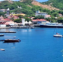
Les Saintes is made up of several islands, but the most visited and popular with tourists is Terre de Haut. Boats leave from Trois Rivières in the morning and return in the late afternoon. The crossing takes approximately 30 minutes.
To explore the island of Terre de Haut, you can choose between walking, renting a scooter, renting an electric golf cart, or taking a group tour. For more information, you can contact the Terre de Haut Tourist Office at +590 590 99 58 60.
In addition to its many restaurants, souvenir shops, and beaches, the island also offers several hiking trails worth exploring: Le Chameau, Fort Napoléon, Fort Caroline, Pointe Zozio, Fort Joséphine, and Pain de Sucre. Before heading back to Guadeloupe, don't miss the chance to buy tourments d'amour, a traditional pastry from Les Saintes, from the vendors in the ferry landing square.
Carbet Falls

Three waterfalls make up the Carbet Falls complex, all accessible via marked hiking trails. The second waterfall is the easiest to reach.
A well-maintained trail through the lush tropical rainforest makes for a pleasant walk beneath the canopy. The trail leads to the vicinity of the second Carbet Falls.
The trail is easy, with a round trip taking approximately 1 hour and 30 minutes. The trails to the other waterfalls are more challenging and longer.
La Soufrière Volcano

La Soufrière is an active volcano, with its most recent eruption occurring in 1976. Rising to 1,467 meters (4,813 feet), it can be accessed from the Bains Jaunes area of Matouba.
The trail is challenging and is not suitable for sandals. The round trip takes approximately 4 hours and 30 minutes, and you'll need a good level of fitness to tackle what locals call "climbing La Soufrière."
The summit is often damp and shrouded in fog and clouds, so it is recommended to bring rain gear and a sweater. Some areas are off-limits, and having a guide is recommended for this hike.
Grand Étang

A must-see, Grand Étang is located along the road to Carbet Falls. You can also hike around the lake on a marked trail. A longer hike is available as well, taking you around several ponds and lakes.
The loop around Grand Étang is an easy hike that takes approximately 1 hour and 30 minutes. An observation point for birds nesting around the lake is located along the trail, with identification guides available to help you recognize the local birdlife.
If you have binoculars, bring them along for birdwatching. One last thing: swimming in the lake is strongly discouraged.
Bassin des Amours

This charming hot-water pool, easily accessible from the road, is shaped like a heart and has a shallow depth of around 60 cm (2 feet), with a small stone bench along the edge. The water temperature is approximately 30 to 35°C (86 to 95°F). A small free parking area is available nearby.
It is recommended to visit in the morning rather than later in the day to avoid the afternoon crowds. The access path takes about 2 minutes and is easy to walk. The pool is nestled in the lush tropical rainforest.
The pool is regularly maintained by the municipality of Gourbeyre, and the warm water comes from natural geothermal activity.
Fort Delgrès

Originally known as Fort St. Charles, Fort Delgrès, whose construction began in 1649, takes its name from a former mixed-race military officer who fought in Guadeloupe against Napoleon's forces sent to restore slavery in 1802.
The entrance to this fort, located in Basse-Terre, is free of charge. It features two exhibition rooms, outdoor areas, and an observation point.
Fort Delgrès played a crucial strategic role during the colonial era, allowing control of navigation through the Les Saintes channel.
Bassin Bleu
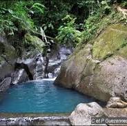
Bassin Bleu is located in Plateau Palmiste in the municipality of Gourbeyre. It is a beautiful natural pool fed by a small waterfall.
The trail is fairly easy, with the one-way hike taking approximately 20 minutes. You can also continue farther along the trail toward the Parabole waterfall.
The access path crosses privately owned land maintained by the owner, who charges a €5 access fee.
Rivière Rouge

Rivière Rouge is located in the hills above Matouba. It is easy to access, as the river is just a few yards from the small parking area along the road.
Located in the heart of the tropical rainforest, it is said to be the coldest river in Guadeloupe. A quick dip is enough to help you escape the heat for much of the rest of the day.
Along the road leading there, at a bend in the road, you'll find the site where Delgrès and around one hundred of his soldiers died in 1802, crying out for freedom. This historic event is commemorated by a memorial stele.
Grande Anse Beach

This long volcanic black-sand beach, lined with coconut palms, stretches for more than 800 meters (2,625 feet) and offers spectacular views of the Les Saintes archipelago.
Grande Anse is known for its strong waves and is a favorite spot for bodyboarders. Access is easy, with a parking area located right beside the road.
Several restaurants are located near this beach, which is pleasantly shaded in the afternoon.
Houëlmont Interpretation Trail

This very easy, marked 2-hour hike will introduce you to Houëlmont pond and its endemic dragonflies.
The drive to the trailhead is magical and, as a delightful surprise, you may even spot contemporary sculptures along the roadside.
This forest walk begins next to the Guadeloupe Volcanological Observatory.
Bains Jaunes

Bains Jaunes, nestled at an altitude of 950 meters (3,117 feet) in the heart of Guadeloupe National Park, consists of two pools fed by volcanic thermal springs from the Soufrière massif.
Easily accessible by car, Bains Jaunes is also the starting point for several hiking trails, including the trail leading to the volcano's summit.
A few miles before reaching these pools, along the road, you'll find a picnic area equipped with covered shelters and benches.
La Coulisse

La Coulisse River gets its name from rocky sections of this small watercourse that form a natural waterslide, where local children used to slide and play before the days of tablets and electronic games.
This river features several small waterfalls, as well as a larger one that is 8 meters (26 feet) high.
There are two ways to access this site. The first is to take a forest trail from Habitation Duquery. The second, more adventurous option involves walking upstream along the riverbed from Anse Duquery, via the Grande Pointe trail.
Helpful Tips for Hiking and Getting Around
Before heading out, it is best to check the weather forecast. In the event of a weather alert, it is advisable to postpone your outing. In southern Basse-Terre, weather conditions can change very quickly, so a bright blue sky can give way to heavy rain in a matter of minutes.
It is best to avoid collecting minerals or plants, and this is strictly prohibited within Guadeloupe National Park. Avoid hiking alone, and always let someone close to you know your planned route.
Hiking Essentials:
- Good hiking shoes.
- A rain jacket or waterproof clothing.
- Water (1 to 2 liters).
- A sweatshirt or fleece jacket, just in case.
- A fully charged phone.
- Food (sandwiches, fruit, or cookies).
- A walking stick if you need one.
- A change of clothes in a waterproof bag.
- A backpack to carry everything while keeping your hands free.
- A whistle to signal your presence if you need to be located.
- Don't set out too late; night falls quickly in Guadeloupe.
- A flashlight in case you get lost and night falls.
Off-the-Beaten-Path Discovery Links
Of course, this page cannot showcase all the hidden beauty of southern Basse-Terre—it would simply be far too long. So, if you'd like to explore further, here are a few carefully selected websites for you.
- Protected areas: Guadeloupe National Park.
- Hiking website: Rando Guadeloupe.
- Another hiking website (not very up to date): FF Randonnée Guadeloupe.
- Guided tours: guided outings and guide listings.
- Wildlife and plant life: Regional Biodiversity Agency of the Guadeloupe Islands.